
24 – 29 January
Beit Bridge. Just mention the name to any South African self-driver and the horror stories start, days long queues, corruption, bribes, police clearance hassles, infuriatingly insistent touts, endless searches, made up rules.
Well it’s much better now. Promise.
Am setting out the border experience in more detail than I usually would just because it’s Beit Bridge. For more detail (and on travel specifics like costs and other logistics) I am following the lead of others and adding a short section at the end of each post with this called ‘Notes for Travellers’ which may be of help for those planning a similar trip.
We had some idea what to expect at Beit Bridge as we last passed through last year (May 2022) on our way to Gonarezhou. At that stage the one stop border construction was nearing completion, but the many departments were scattered in mobile containers / various pre-fab buildings throughout the border compound. None of which are sign posted and the order in which to visit what is a mystery. All this feeds into the tout / helper market, the touts are persistent beyond and in takes a very zen mindset not to get irritated. Getting oneself through is a simple process – no visa is required for South Africans (well, you get it on arrival) and you simply present yourself at immigration and get your passport stamped. It is clearing the vehicle and what you may be carrying that is the hassle.
We have a policy of not using touts / runners / fixers wherever possible, feeling that it feeds into a corrupt mindset and the expectation that (what should be free) public services are not accessible unless a fee is paid to oil the gears. We feel that in paying a tout you just make things worse by encouraging this thinking, and you make things even more unpleasant for fellow travellers who don’t want / need their services. There are moments though, when I wonder if we should get off our moral high horse – it would make things a lot easier all round sometimes.
As I understand it though you can arrange for a legit representative from Zim Tourism to meet you at the border and take you through the process. This needs to be booked in advance – it is not an option we took, but others have, and with success.
Anyway the one stop border is now in one building -and a very smart building it is, with external stonework a la Great Zimbabwe. So only one building but MANY counters and a random order in which to visit which counter. But the staff are pleasant enough and tell you with counter to go to next. And the bulk of the touts are kept out (only the most slick have found a way in). The Zim TIP* process went online some time ago, ZIMRA have an App where you apply online, entering all the owner and vehicle details ahead of time getting a ref number that you present at the border – the official can call up those detail and issue the TIP without having to enter it all again. Happy days. We used that system last year.
An explanation of the acronyms for the benefit of those readers (and I know there are some) for whom this whole overlanding thing is a complete mystery. A quicker BORDERS 101 if you will. Most readers can skip this, for the rest: concentrate mense! It is important for an understanding of the various trials and tribulations that are bound to follow.
(*) TIP stands for Temporary Import Permit – you apply for this to import the vehicle temporarily, so as to be exempt from the import duty that would be payable if you were bringing the vehicle into the country on a permanent basis. Most countries require some form of this.
The only time you don’t need a TIP is if you have a Carnet (or CDP, Carnet du Passage). Unless the country doesn’t accept the Carnet (like Zim) or insists on a TIP in parallel. I will include more on the Carnet in the Notes for Travellers sections in later posts.
In addition to the TIP and / or Carnet each border crossing / country attracts a host of other vehicle related fees such as a road tax / toll fee, a carbon tax and 3rd party insurance (not to be confused with the short term insurance on your vehicle which is not compulsory). This 3rd party insurance is bought from private insurers per country, and can also be bought for certain countries as a group via the COMESA (Common Market for Eastern and Southern Africa) yellow Card system. I will include more on the Yellow Card in the Notes for Travellers sections in later posts.
So back to the ZIMRA online TIP application…we tried to do this before leaving Zvakanaka (our campsite near Louis Trichardt with great hosts Gail and Al and a warren of the cutest baby mongooses!). But the App was out of commission, and directed you to the website. Here the hassles started. The system recognises us, but does not pre-populate our details, with basic details being continually rejected for being “in the wrong format”, despite trying many, many variations. Take our telephone number as an example: so we try with the +27, without the 27, with spaces, without spaces), eventually accepted the phone number…then on to our address… 8th Str, 8th Street, Eighth Street and on and on – you get the drift. Couldn’t get it right, and our connectivity was dodgy, so we left for the border reckoning they could help us out and do it manually there.
Wrong.
We are informed that the online TIP process is mandatory. No, they are not sure what we are doing wrong – told to “just keep trying”. What follows is a hot flustered hour or so. We have no Zim SIM yet, so rely on on / off SA signal, iteration after iteration of this form, Kafkaesque doesn’t do it justice – all the time with various Mr Slicks posing as a travellers and trying to “help”. Eventually we get it through – after stumbling over the vehicle value (Different amounts, ZAR vs US$, etc) many times. I think that what happens is, despite it not pre-populating details, if you are already registered it rejects any detail (including vehicle value) not submitted in the exact same format as previously. Anyway that’s my theory.
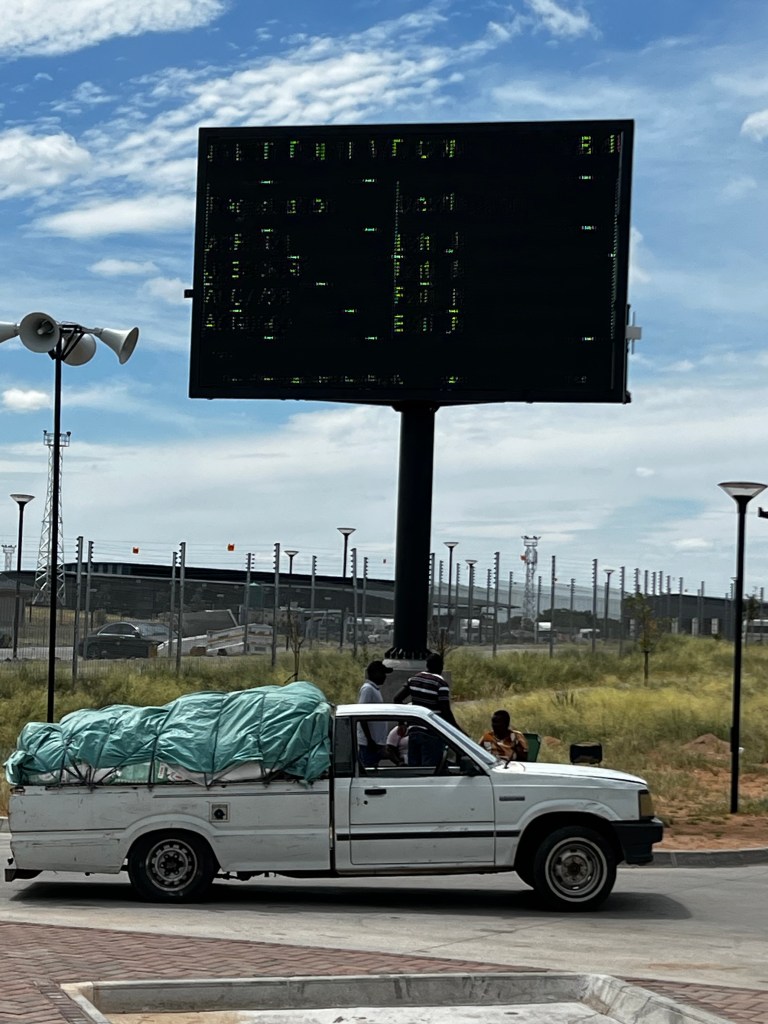
The whole Zim border procedure is further digitised with a slip and QR code issued as you start the process. This code is scanned at each stage and you cannot proceed unless all steps up to that point are in order.
Once done (final step being the customs officer’s physical inspection of vehicle) you are good to go and your reg number comes up on a big electronic billboard at the exit gate. It’s like winning the Superbowl!
So border over we make our way into Beit Bridge town for the “new country” essentials: local SIM and beer. And then we are finally off up and on the road to Bulawayo. And it’s not a great road , lots and lots of potholes and the shoulders eroded away. But it feels good to finally be on the road out of SA after all these months of plotting and planning and all the stress of preparing to leave. Time is getting on though, and we push on as quickly as we can.
The destination for today is Matopos range just South of Bulawayo, where we are due at The Farmhouse just outside the Matobo National park. Whilst I’d researched the camping spot, I hadn’t really paid attention on how to get there, assuming we’d just take the road leading off the main road, across and up though the Matopos. So we blithely follow the GPS and T4A routing, and it all starts well as we turn off the main road onto good tar (way better than the main road in fact) and potter along through small villages, enjoying the countryside, and then good graded dirt as the road winds along, gradually getting narrower, we follows the GPS instructions and things get more rural and the road less travelled. On and on we go. Eventually we are down to a twee spoor track and it doesn’t look like any one has been here for a while but we keep on. We try and phone the Farmhouse but the reception is awful, but we manage to WhatsApp to say we are running late. On and on we go. In parts the road has been washed away and we are having serious doubts – but you know the feeling, we’ve invested quite a bit of time on this route and are reluctant to give that up. But eventually we call it, we have no cell coverage, and its starting to get dark, and storm clouds are brewing with lightning flashes on the horizon. So we turn around and resolve to try and find our way back to the tar. And on and on we go.
I am now kicking myself. I should have planned this route better, not just assumed. But it’s Zim, the Matopos, how hard can it be? It’s only day 2 and we are hopelessly lost FFS. We’ve consulted all the maps (offline , digital, paper) – and we are , in short, beyond lost. And when you are lost like that none of these aids help. And the anxiety levels start to rise. But I drum up from somewhere a feeling of which way is back . On and on we go.
It’s almost dark and we come around a corner to find a flooded causeway – the water is pumping across it and flowing far too fast to try and cross. We get out and stare at it. There is a man fishing so we get talking to him. He is the local schoolteacher. Yes he says, this is the road to Bulawayo, back to the tar (he points across the causeway). Is there another way? Yes, he says, launching into a complicated explanation that assumes lots of local knowledge. We get out the map. He tries to show us but in my heart I’m not optimistic. He offers to show us to a turn off a few km’s back So the three of us set off and we get the instructions, dropping him off back at his village. And on and on we go. It is now dark. Properly dark. Reception is intermittent. We manage to get a message to the Farmhouse to say don’t wait up, we’ll see you tomorrow (hopefully). And on we go, more stopping, more asking.
And eventually we hit the tar. We end up overnighting at Trigger Lodge, Gwanda. Mainly cos they were the first to pick up the phone and the lady at reception sounded so cheerful and welcoming with that melodic Zim accent. Trigger Lodge has seen better days – typical of many Zim motels way past their heyday, battling the mould and encroaching rainy season plant growth, held afloat by the same mix of semi permanent lodgers: invariably single men, local and South African contactors working a mix of trades but usually in construction.
But we are here. And a beer never tasted so good.
But it got me down. Getting lost that is. Left me feeling unprepared with lingering imposter syndrome. There is so much planning and reading that goes into trips like this. Some bits going years back, stuck in muscle memory hopefully to be retrieved at some point. It’s very different to a shorter trip which tends to be more planned, more regulated given the usual dovetail restrictions of work on either side. On those trips the surprise comes from deciding between Woollies lamb chops or Craighall Meat’s chicken pregos for supper. This is different.
I do admit to being somewhat dismissive of those who plan every stop of long term trip, chart every day’s travel on Base Camp, download and follow others’ GPX tracks religiously. Now I’m not so sure. I flirted with Base Camp ahead of this trip and tried to download some other travellers GPX tracks onto our GPS but got frustrated with the software and gave up, figuring we’d make do as usual with paper maps and offline digital open source maps like MapsMe, T4A on the GPS, and try iOverlander (new to me) when have reception. But now I don’t know. And the gloom sets in.
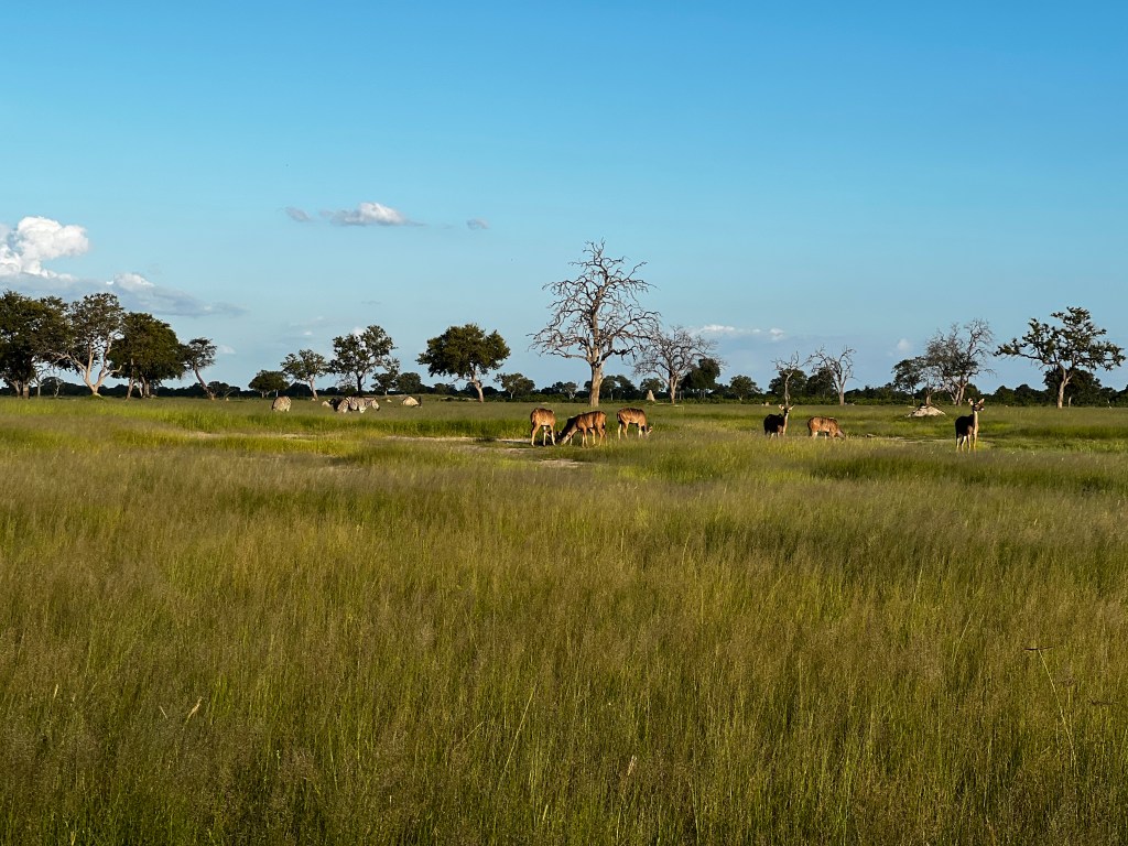
Anyway, a good night’s sleep is a wondrous thing and come morning we are soon on the road and by late morning are at the Farmhouse, a lodge and campsite that overlooks the Matobo national park and which has a campsite with the best of views. There is also game (giraffe, wildebeest, Impalas, Zebra ) – all are pretty chilled , probably because they are supplement fed, a practice started by the owners during extreme drought but now continued.
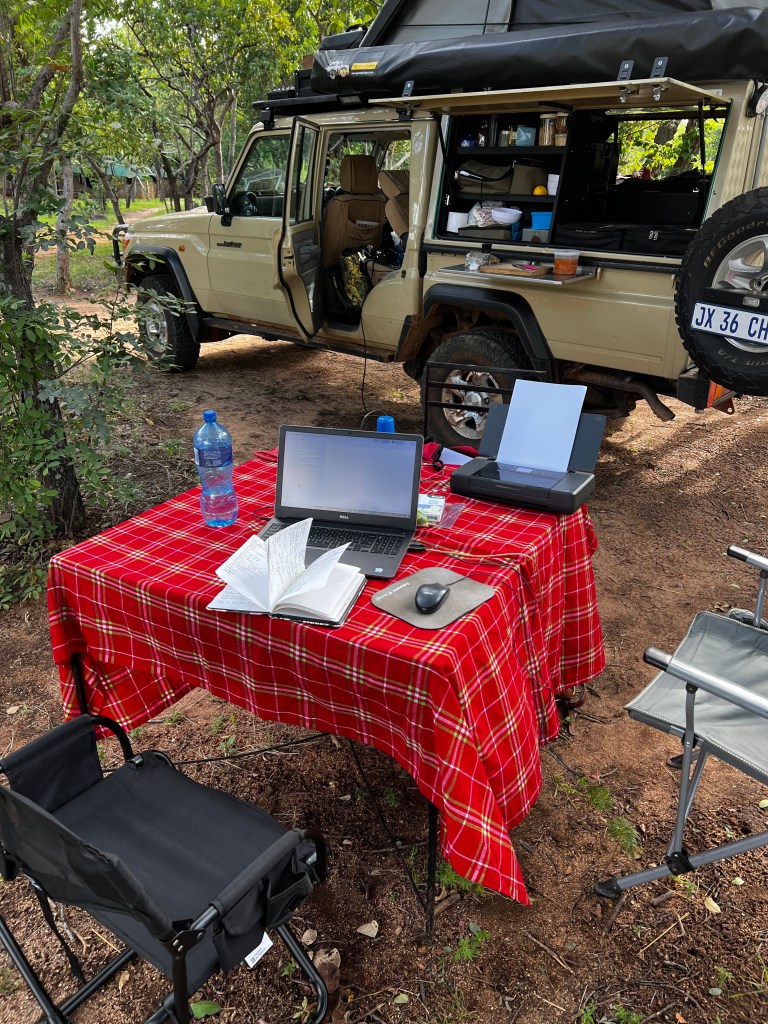
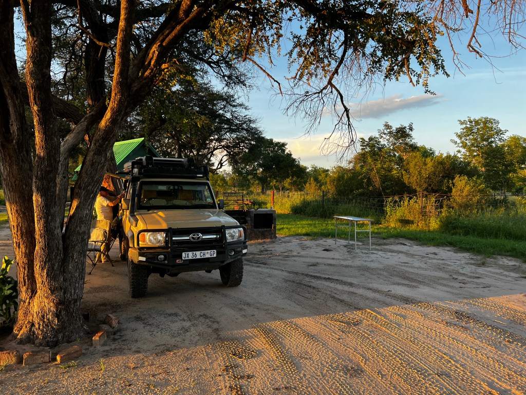
We chill the rest of the day (day 3 and we need a rest!) and also to do a bit of work, setting up the mobile office for the first time.
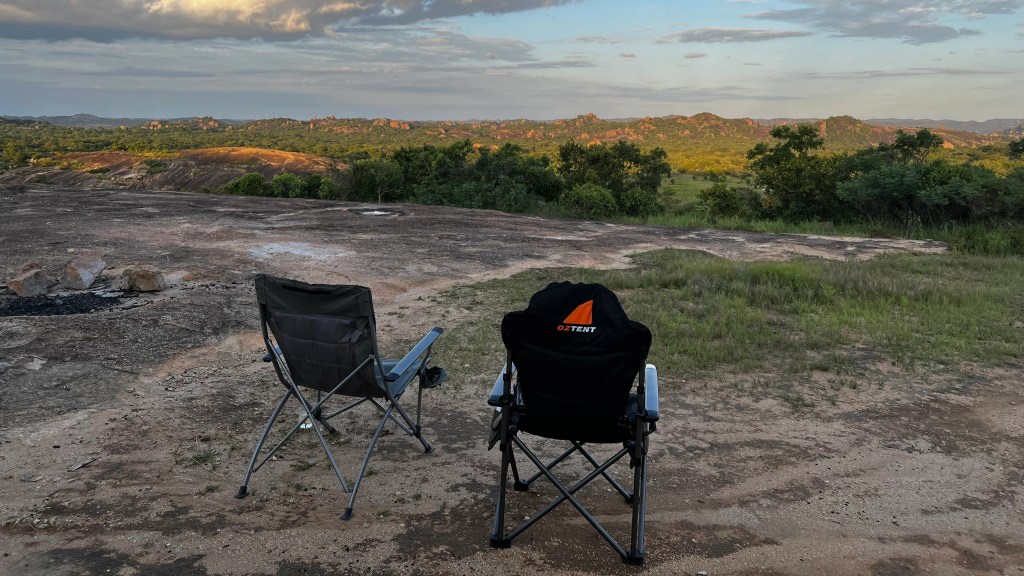
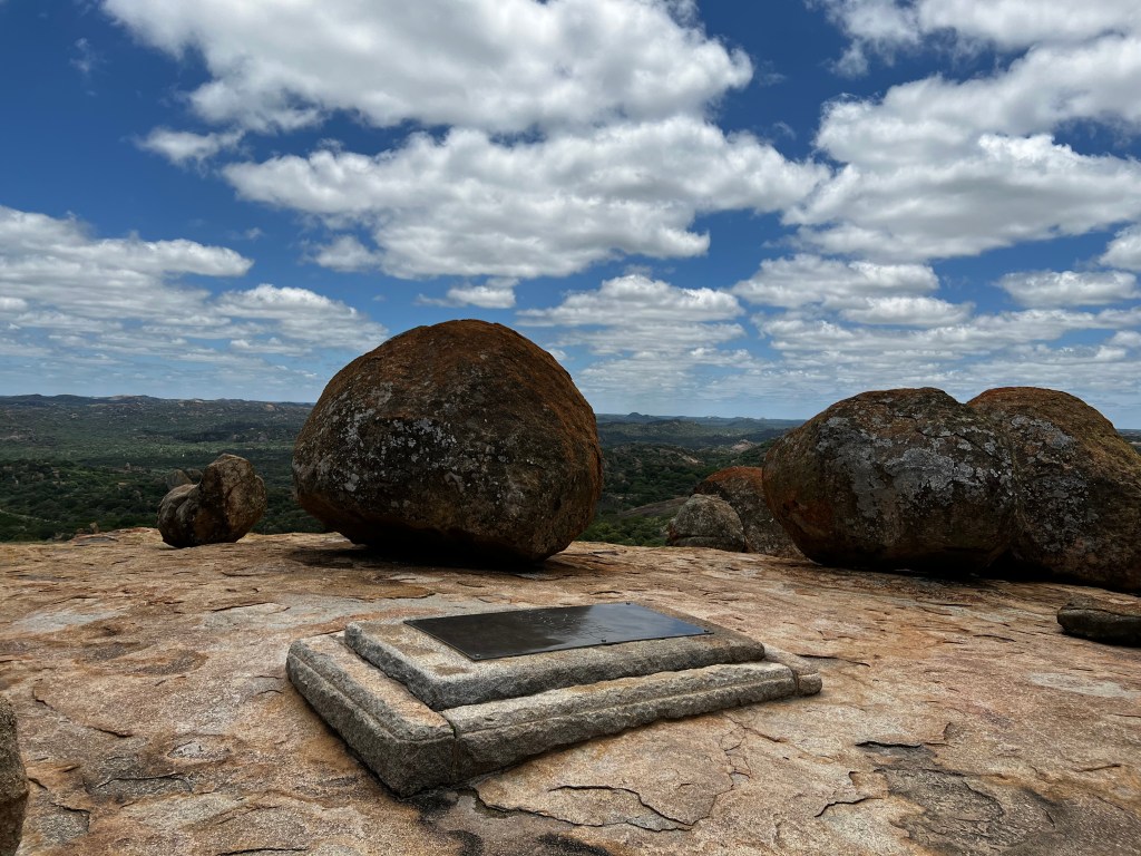
That evening we have sundowners looking out from the big granite boulders and have to don jackets against the fresh wind. Once you know what to look for you can see Rhodes’ grave from this spot.
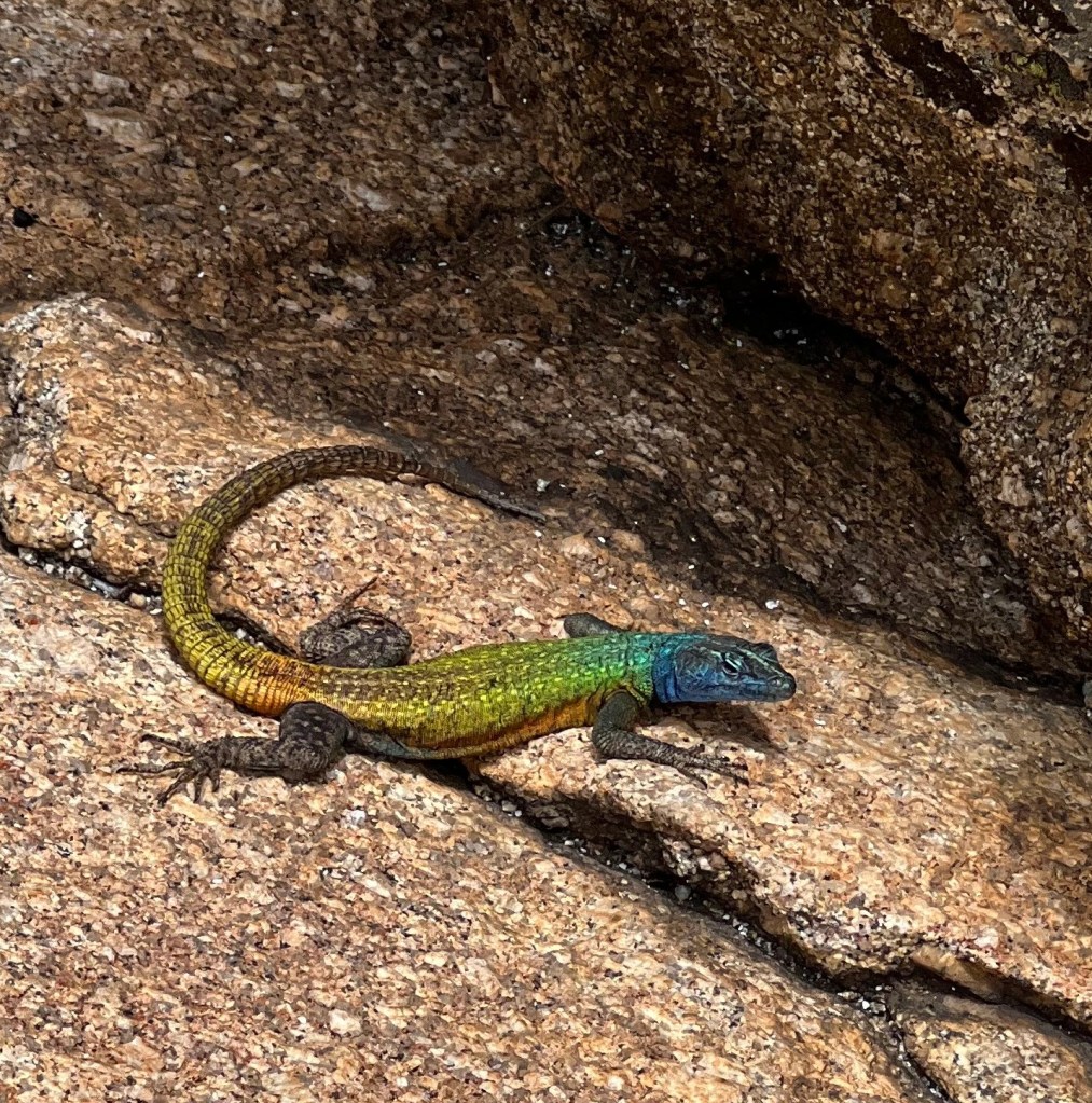
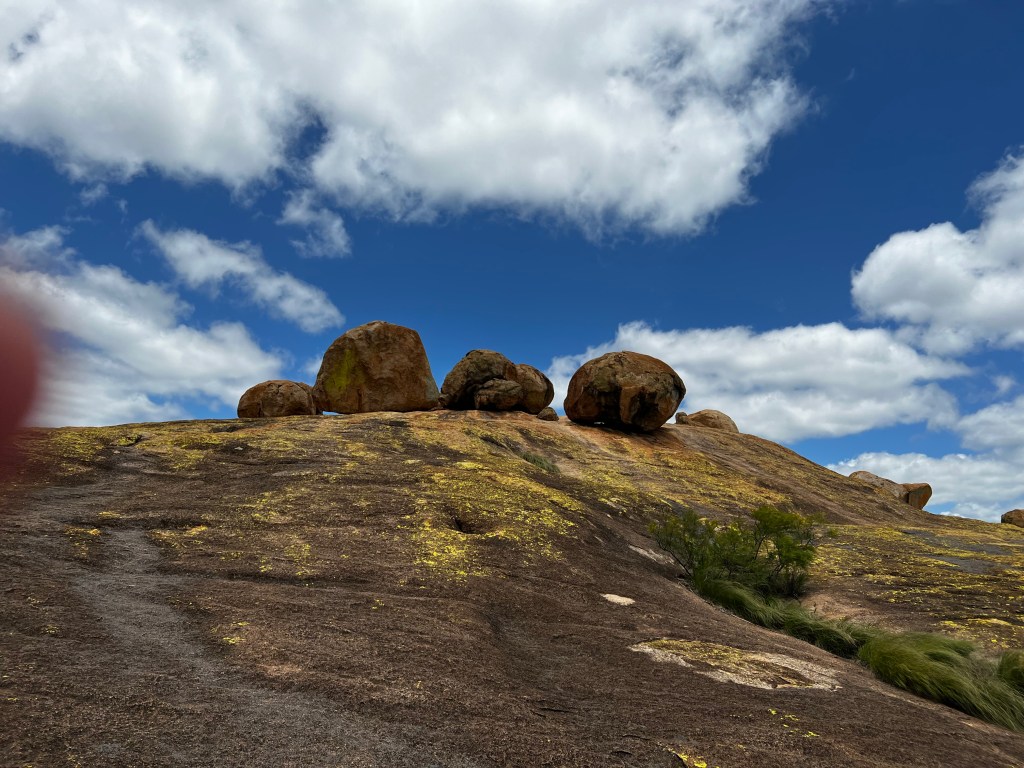
Next day we go into the park, and spend the day exploring and admiring the endless koppies with impossibly balanced boulders and rock formations. We make the obligatory visit to Rhodes grave – and whatever you think of the man he chose a great spot, with 360 degree views. It is very odd though the way the whole site is revered. Loads of lizards skittering around on the top – resplendent in their rainbow livery.

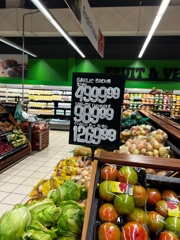
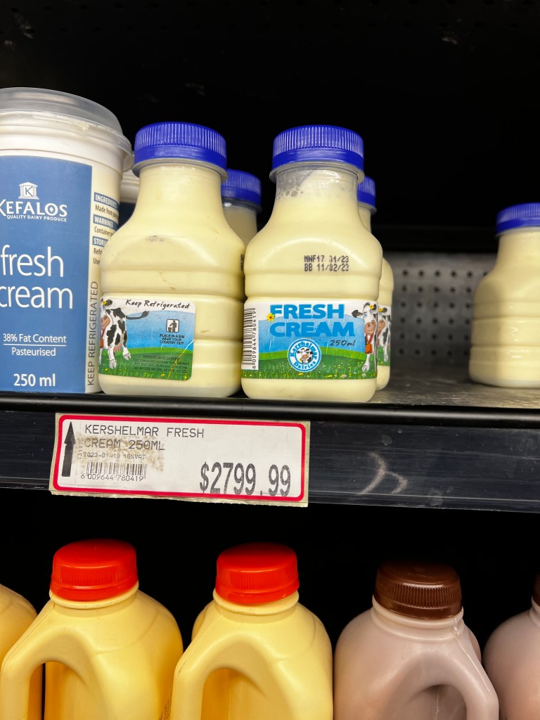
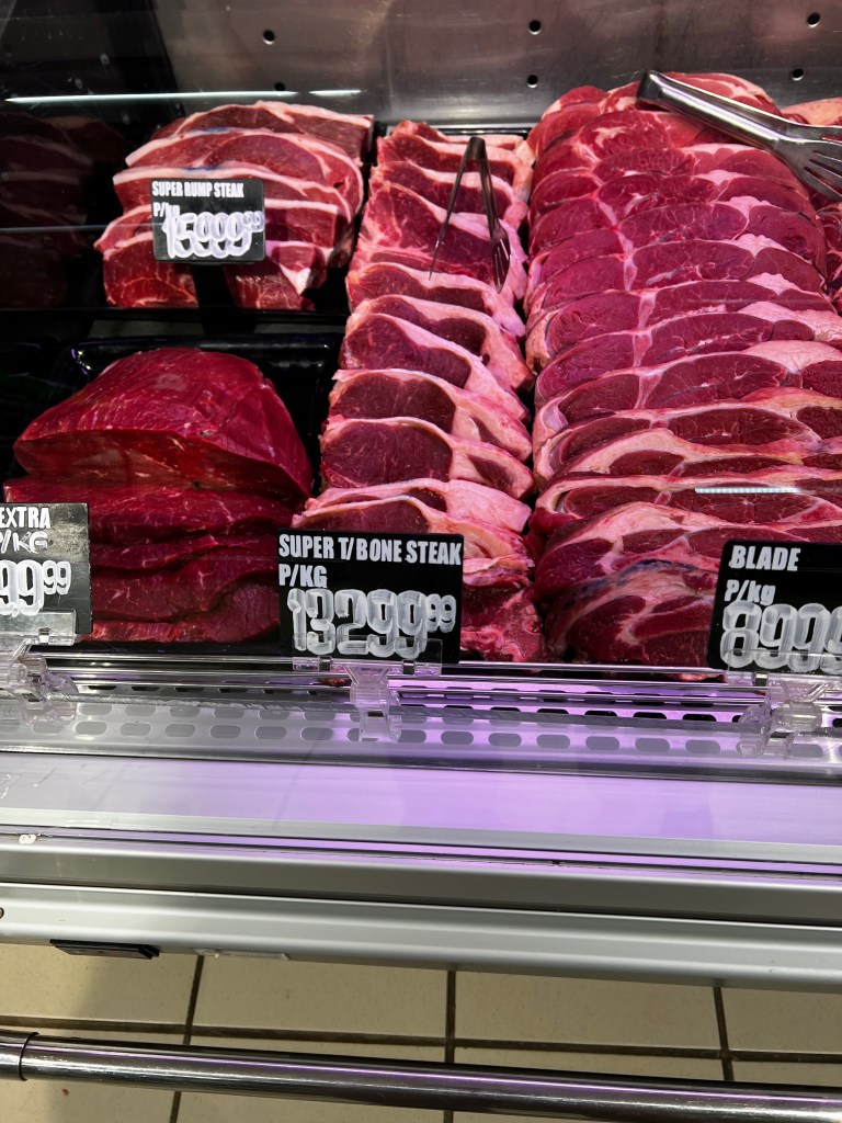
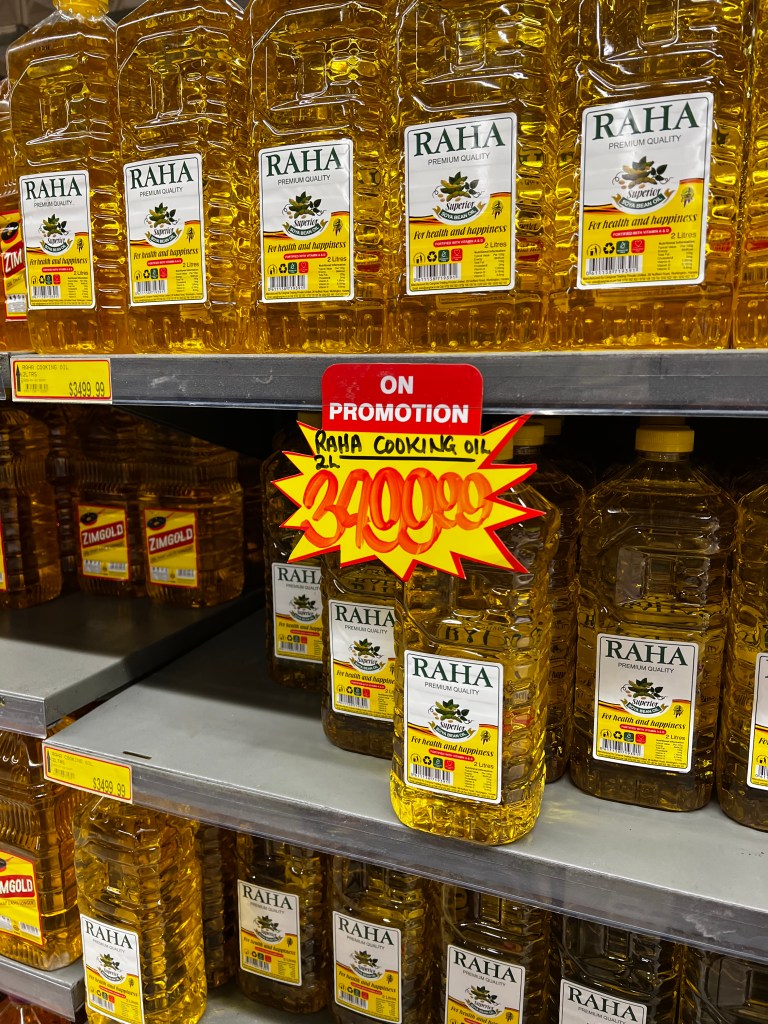
From the Matopos we keep heading on up through the country, stopping in Bulawayo at Bradfield Pick and Pay for a few items (foot and mouth, as well as fruit fly restrictions meant that we could bring no uncooked meat through the border, nor any fresh fruit and veg – not that we were searched I might add). Change is an issue and I was asked to choose sweets in lieu of change. There are a few local brands but the bulk is imported from SA and carries a hefty premium.
Navigating prices takes some doing, as all prices are quoted in RTGS, with retailers displaying going rates (as I found out) at the front of the shop, like so (scroll across for some examples of pricing):

The Bradfield shopping centre clientele is a diverse mix: construction workers in hi viz gear, young happening Zimbabwean couples and many older white Zimbabwean pensioners, scanning the specials and looking hard up. It can’t be easy. I get chatting to one such old lady – at the beer fridge – she is soon visiting her son in Australia, and has been tasked with bringing a bottle of Castle Beer out. But it MUST be the one made in Zim not in SA. Am sure there are many like her whose kids have moved away, and here they are trying to eke out a living on pensions decimated by hyperinflation and financial turmoil. They have a gritty resilience about them.
Bulawayo looked good and had some bustle and energy about it. Properties varied widely in terms of state of upkeep, but overall a pleasant suburban sprawl, with flamboyant trees and glorious bougainvillea. But with, I hate to say it, a faint but pervasive whiff of sewerage hanging over the town. A bit like Joburg.
Ready to get some bush under our belts, we head for Hwange National Park. I have fond childhood memories of family trips here, travelling down from the Copperbelt in what was then Northern Rhodesia in Dad’s old Mercedes to tour “Wankie” as it was then called.
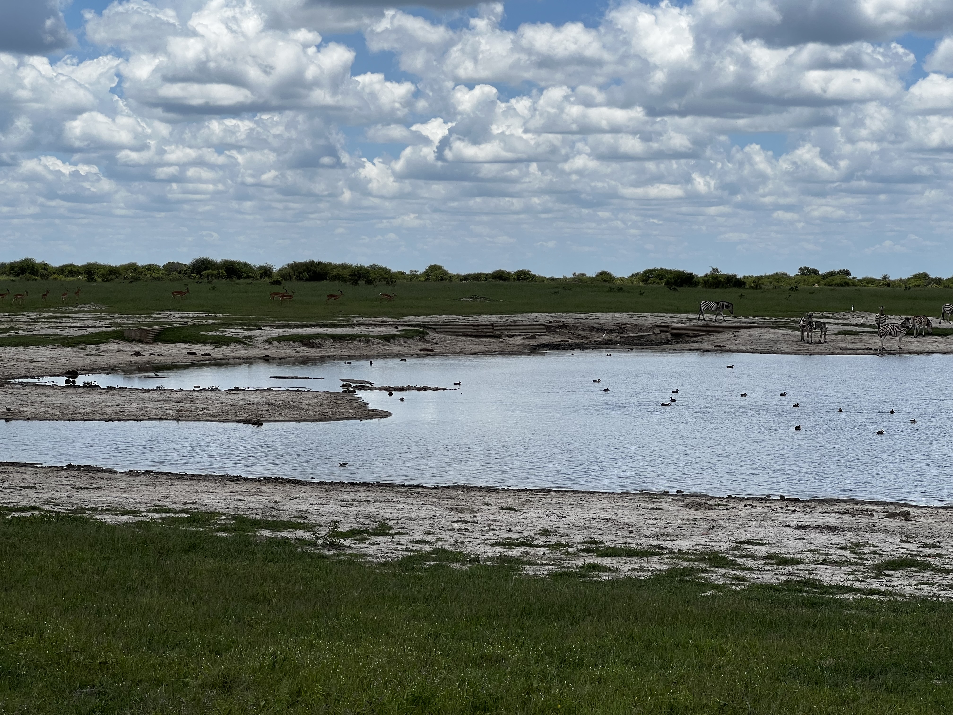
Main camp has a bad rep for being run down and depressing. We didn’t think so. There is a brand new (operational) petrol station, grass was trimmed, (it was green so that helped), quite a few cars and people about, efficient reception staff. Our options were either to camp at the public campsite at Main camp or try for one of the picnic sites. Many of the picnic sites within Hwange allow overnight camping and provide loos and showers / washing up stations for this. These are expensive to pre-book as you have to take the whole site (charge min 6 people), but you can, if they are free, get these at a way reduced walk-in rate. It’s low season so I ask – and way-hey! Am offered a choice of either Kennedy Pan or Ngweshla. We opt for a night at Ngweshla. We are the only people there.
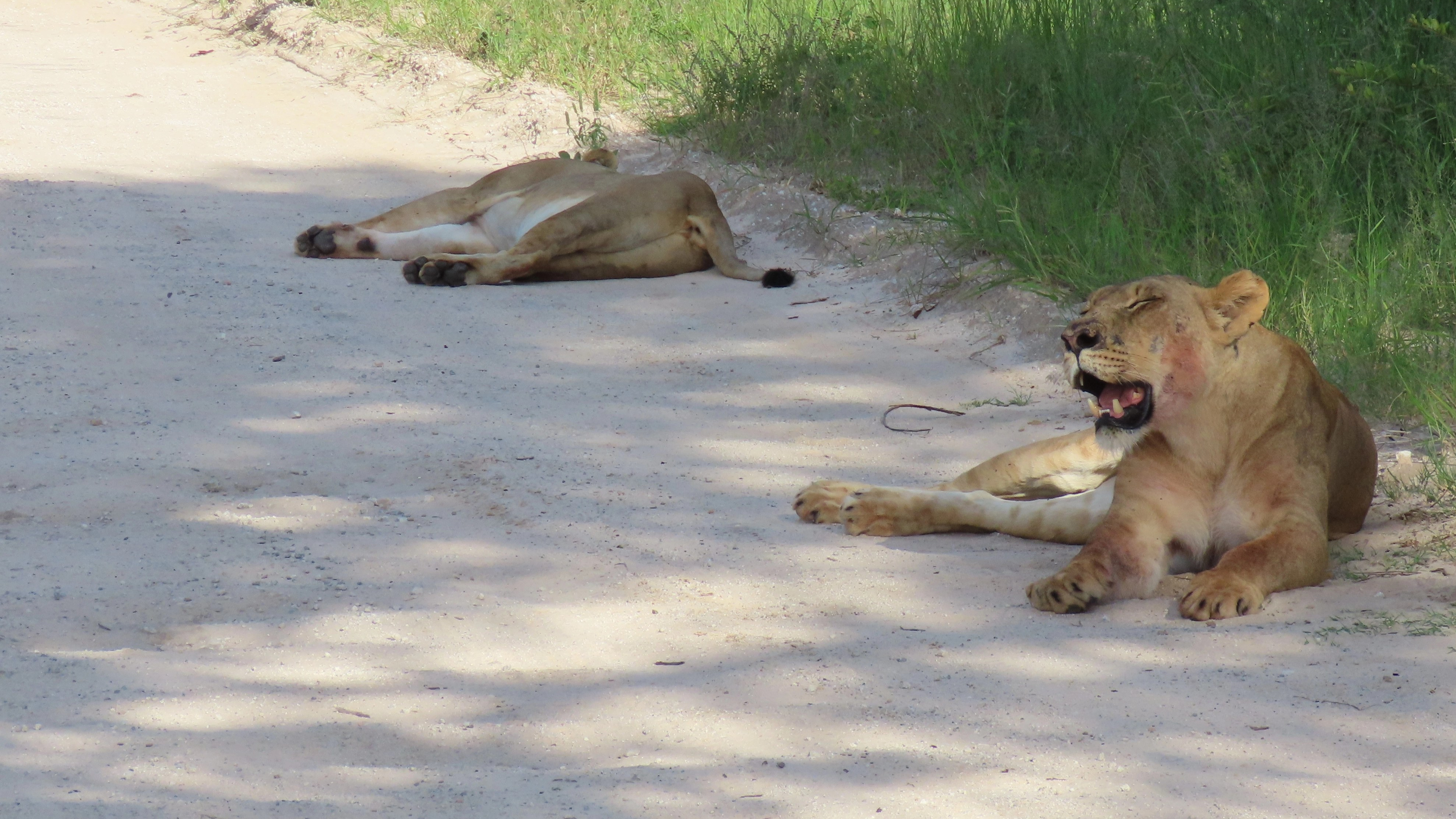
The game drives south of Main Camp are special – with a series of pans covered in what can only be described as meadows of grass. The grass is long (waist to shoulder height in places) so the spotting is tricky but it is so beautiful, lush and green and the game fat and shiny. Plus on the way to Ngweshla we come across two fat lionesses chilling in the road. They have just eaten, faces still a bit bloody, and panting from the exertion of digesting a big meal. Wonderful to see cats in such great shape.
Had we known how beautiful the area was, and what a great spot Ngweshla was, we would have taken a second night. But no reception so we couldn’t call back to main camp and to drive back to Main Camp and double back would take the better part of a day
We also checked out Kennedy which was lovely too (although I think Ngweshla takes the cake). We also stopped at Jambli, which although loos and showers looked serviceable, was somewhat overgrown and the caretaker cottage empty. So I am not sure if camping still offered here. It certainly had not been used in a while and we were not offered it as an option at Main Camp reception. That may also have been due to its location (the furthest of the 3 from main camp and time would not have allowed is to reach it before 6pm closing).
We moved on to a night at Robins camp in the north, driving the main “tar” road though the centre of the park. The ‘tar’ is almost completely eroded and potholes are huge – be better to tear the whole thing up and grade it. But anyway it is a nice drive through (although I still think the southern pans are the jewels) and we see lots: plains game, elephant and large herds of sable which reminds us that this is Zimbabwean rather than South African bush.
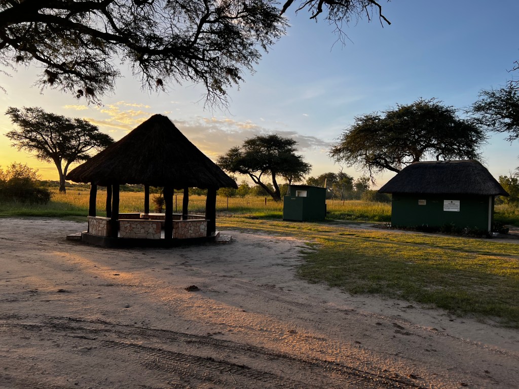
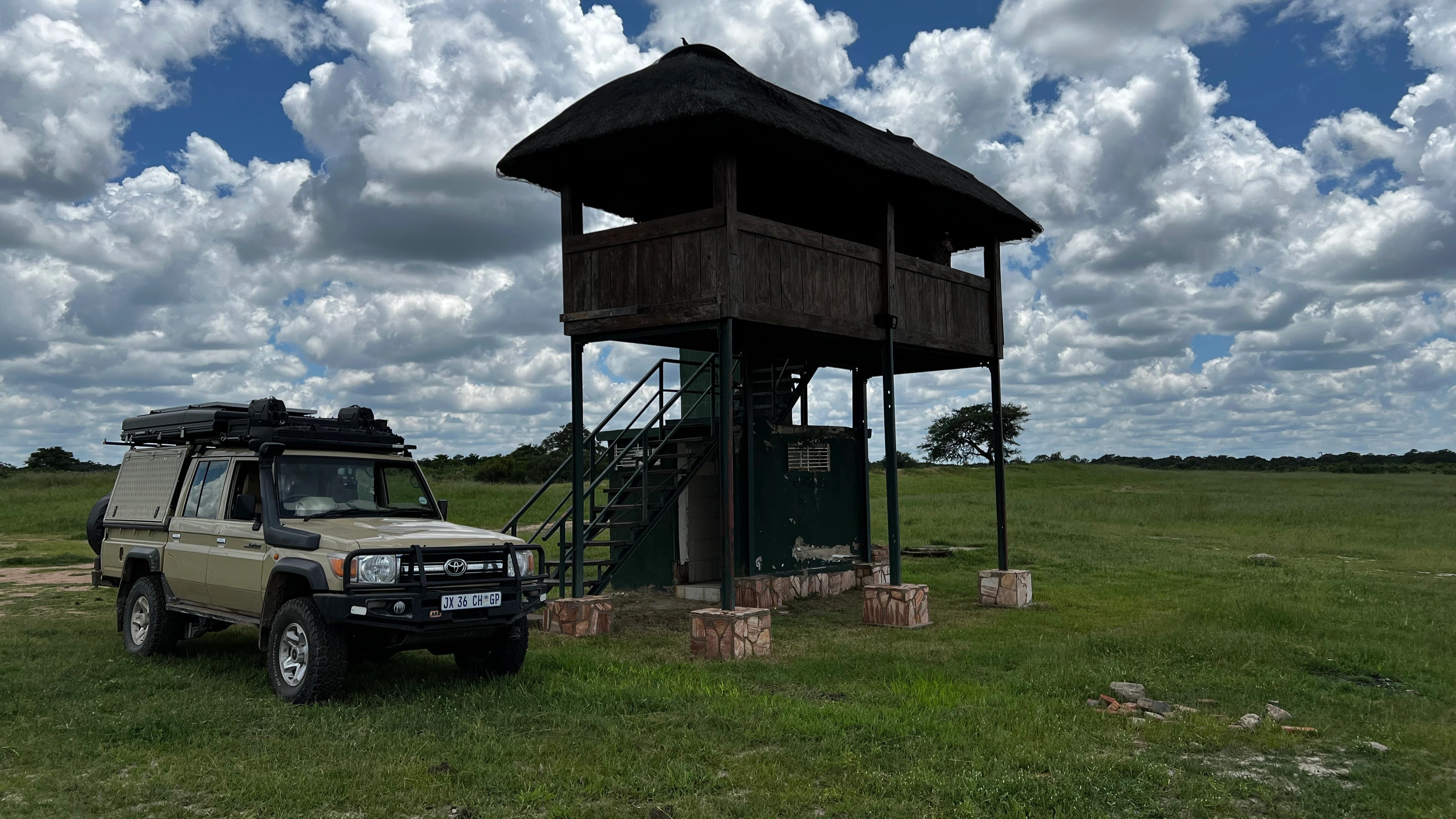
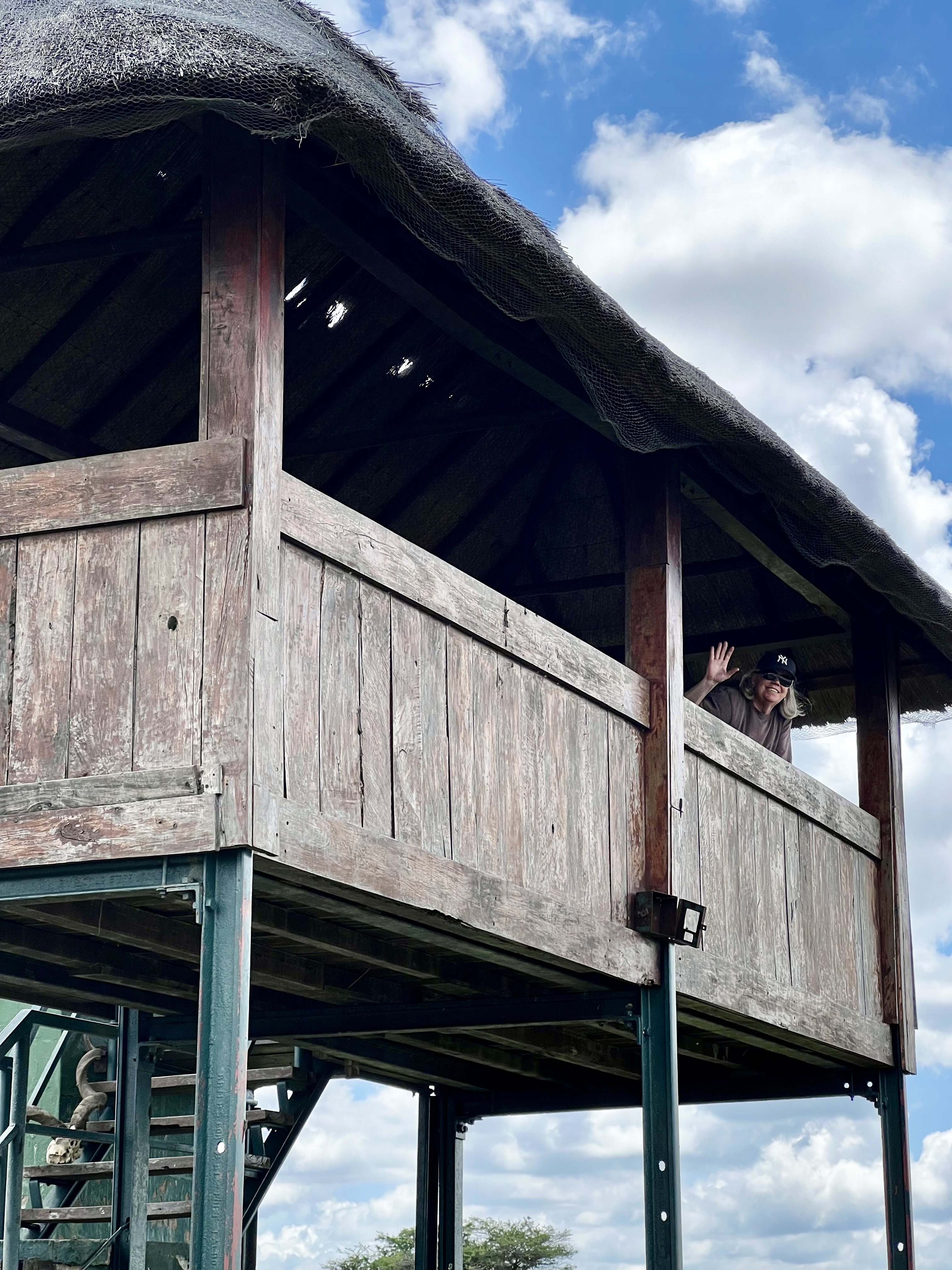
We also stop to check out Guvalala platform – this raised platform with loo and rudimentary shower below – can also be booked to stay overnight – great spot with a busy pan in front of it:
At Robins we are once again the only guests. Just us in the campsite and nobody in the accommodation. Apparently the past week has been almost constant rain, putting visitors off. There are many side tracks that are submerged and we get out in places to prod with the walking stick (I have Dad’s walking stick that I bought for him on a trip to Lake Turkana some 30+ years ago. It feels so right to be using it on this journey.) At one such track we discover the fog light hanging out – almost comically like a child’s toy with its éye’ out on a spring. Deb to the rescue.
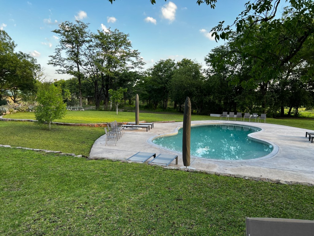
Robin’s camp site is fine – good facilities and well laid out sites, but it is a big commercial site. The lodge is smart with a pool and grassed gardens and restaurant. Campers are welcome and we enjoyed a couple of cold beers overlooking the pool.
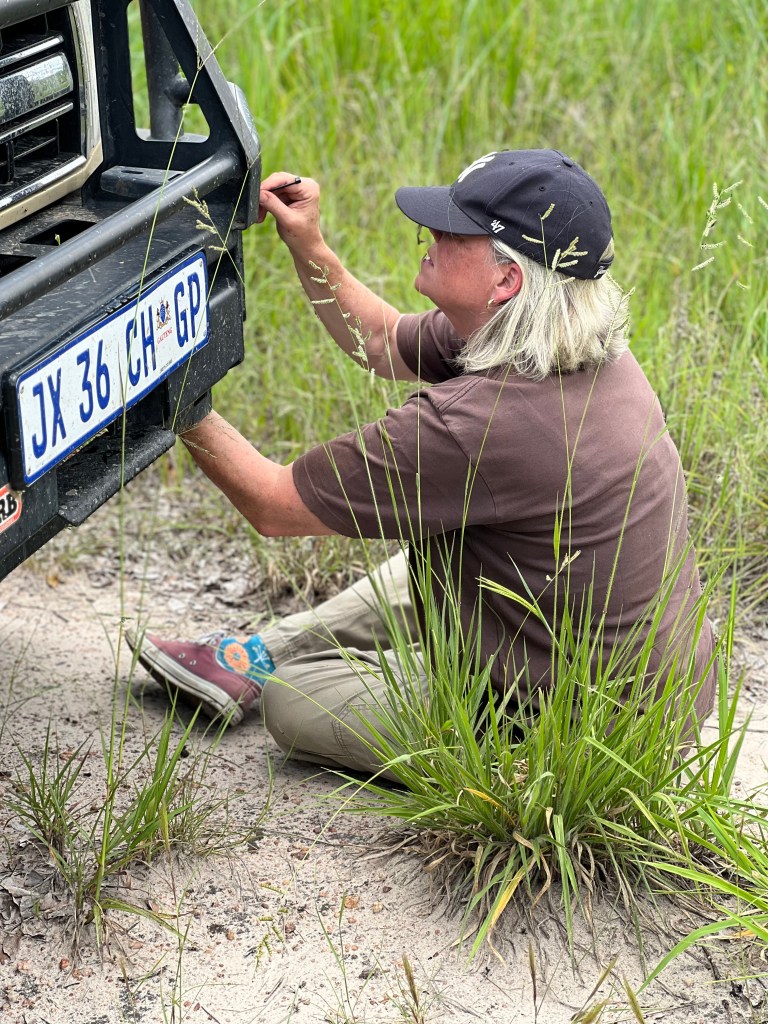
In the morning freshly showered and wearing our clean ‘border clothes’ we set out for a quick game drive to try and find the lions we heard in the night. Prosper, the ZIMPARKS officer (Zimparks has an office at Robins) gives us a loose description of the loop he recommends and suggests we check out the airstrip for the lions. Off we set, the bush is super thick and the grass very high (higher than the cruiser in places) and as we drive through the smaller tracks the bonnet is covered in grass seeds and dislodged insects, with grass growing windshield high on the middle mannetjie. We stop and fit the grass net (this helps stop the radiator grille getting clogged with grass seeds) – it feels great to be putting all the lessons and kit to use.
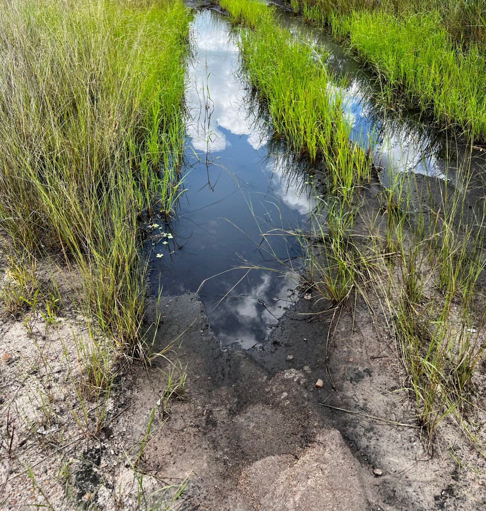
There has clearly been a lot of rain and though tracks are starting to dry out there are still some tricky bits where the track is churned up and underwater and with the tell-tale signs of vehicles having got stuck.
We do fine.
Until we don’t.
And the inevitable happens. We get stuck in deep ruts of black cotton mud. We stop as soon as we feel the wheels spin so as not to dig in further, and get out to assess things. Sjoe this is sticky treacherous stuff – you slip and slide and in the end you feel like you are wearing big black snow shoes. It sticks to everything and our fancy tyres are as good as formula 1 slicks in this mud. We don’t get a thrill out of getting stuck, and try and avoid this at all costs. But what to do? We know we are the only vehicle about so the chances of someone happening along are minimal. We have no signal. So needs must and much digging and swearing and slipping and sweating later (it is VERY HOT) we get the max tracks far enough under the wheels, deflate as far as we dare and drive out. (@ Paul if you are reading this, thanks for insisting on those 4 bits of expensive plastic!)
Back to Robins for a shower and clean up. Prosper helps us get the mud off the Trax and I get under the car to check for grass and I cannot believe the amount of grass and seeds I pull out. It’s like Shackleton went into lawnmower mode . We’ve all been warned of this – of the need to clear grass lest it catch alight against hot engine / exhaust but I’ve never actually done this before and I am astounded at the amount.
From Robins we take the Vic Halls road, exiting to the north and driving though the GMA (Game Management Area) north of Hwange. This avoids the shock of exiting though the coal strip-mining area out of Sinametella.
Vic Falls town is well, Vic Falls. We ponder on the difference in how Vic Falls has (not) developed compared to the thriving town of Livingstone just the other side of the Zambezi.
Next stop Zambia.
NOTES FOR TRAVELLERS
- Zim border costs: TIP – apply using ZIMRA app on the day. Cost at border $50; another fee of $27 (can’t NB what it was for), Bridge fee (ZAR 160)
- We had our Covid vaccination certificates but were not asked for these. No sign of any testing needed. In fact no sign of covid regs at all. Non issue.
- Money matters: We took a lot of SA Rands as well as cash US$ as we understood that credit cards were not accepted at petrol stations. In our experience many (most) garages all accepted credit cards, favouring Visa.
- You always get a better rate if you pay in US$
- ZAR exchange rate was R17 to 1 US$ at the time, and we got this rate in the South, as we moved north however it worsened will retailers, fuel stations etc offering R20.50 / US$
- All larger retailers accept credit card
- Numerous tolls US$2 or R30 each. We paid in ZAR
- No police hassles
- Trigger Lodge (if you have to) $50 – $70 for a double room
- Farmhouse camping (responsive via WhatsApp, all details on their website, don’t be put off by ref to being more set up for larger groups, are very welcoming if individual campers) Camping $15 ppn
- Matobo NP fees: entrance $15ppd plus $4 for vehicle, $7 pp to visit Rhodes grave (this includes access to the various rock painting sites)
- HWANGE fees: North more expensive (presumably because of higher demand out of Vic Falls
- South (paid at main camp) $8ppd plus #3 for vehicle
- Ngweshla Camping $50 ppn
- North (paid at Robins) $15ppd plus #3 for vehicle
- Robins camping $20 ppn
